Subtropical Storm Nicole to begin strengthening as it approaches Florida
Nicole will begin strengthening on Tuesday as Florida’s eastern coast prepares for a possible tropical storm or Category 1 hurricane later this week.
BULLETIN
Subtropical Storm Nicole Intermediate Advisory Number 5A
NWS National Hurricane Center Miami FL       AL172022
700 AM EST Tue Nov 08 2022

...NICOLE BEGINNING TO STRENGTHEN...
...EXPECTED TO TURN WESTWARD OR WEST-SOUTHWESTWARD TODAY...


SUMMARY OF 700 AM EST...1200 UTC...INFORMATION
----------------------------------------------
LOCATION...27.7N 72.0W
ABOUT 385 MI...615 KM ENE OF THE NORTHWESTERN BAHAMAS
MAXIMUM SUSTAINED WINDS...50 MPH...80 KM/H
PRESENT MOVEMENT...WNW OR 300 DEGREES AT 8 MPH...13 KM/H
MINIMUM CENTRAL PRESSURE...992 MB...29.29 INCHES
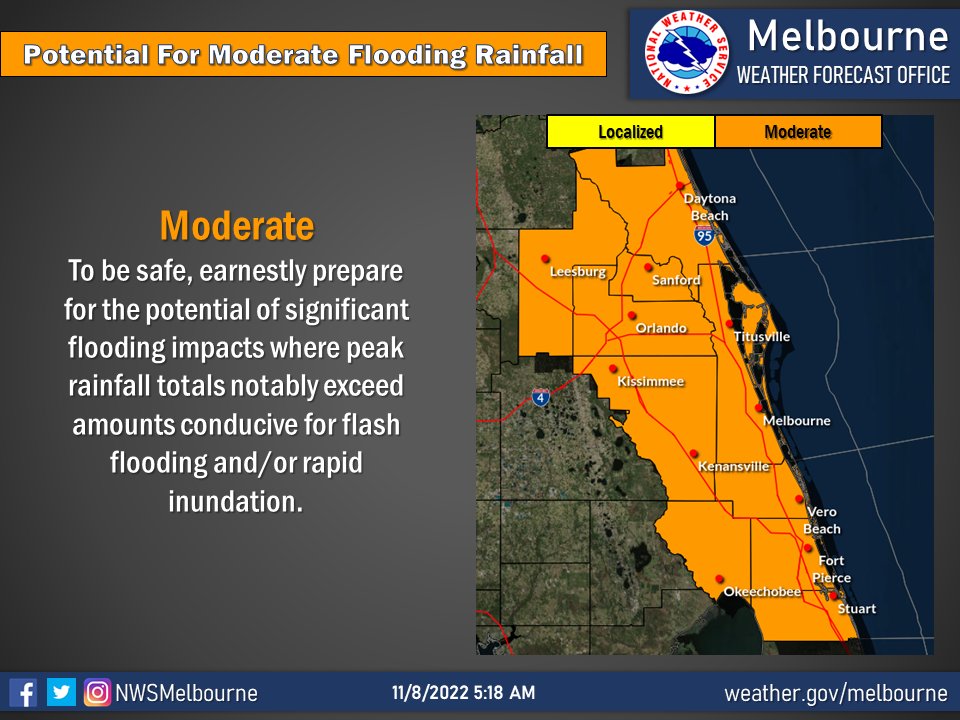
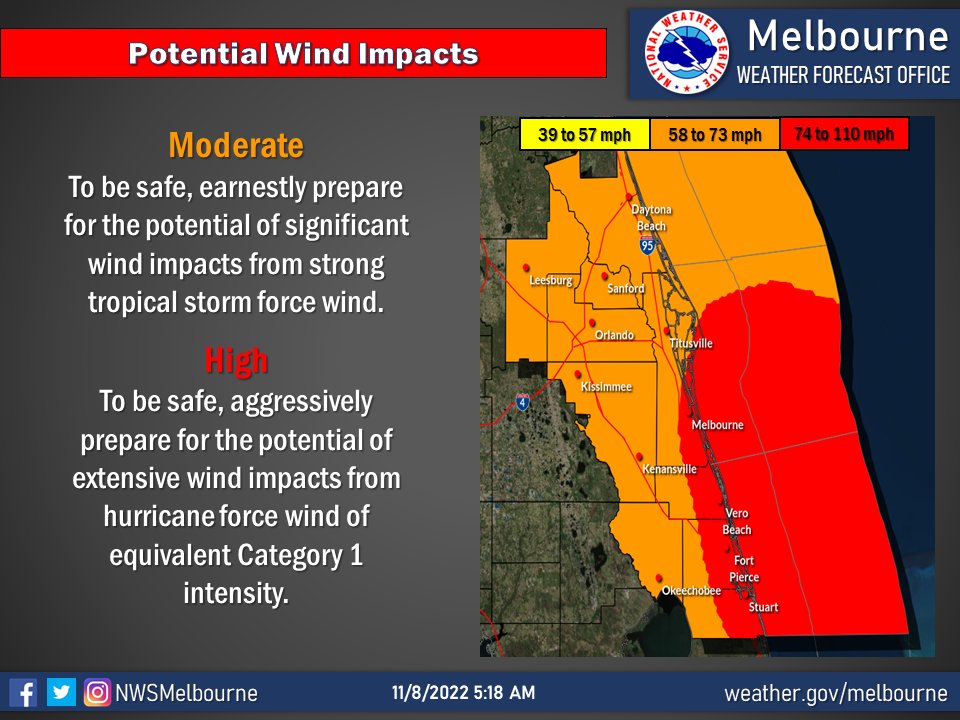
The storm, with sustained winds of 45 mph, is traveling northwest at 8 mph. In addition to the hurricane watches already issued along Florida’s east coast, the hurricane center early Tuesday issued a tropical storm warning for portions of the state’s western coast.


SUMMARY OF WATCHES AND WARNINGS IN EFFECT:

A Hurricane Warning is in effect for...
* The Abacos, Berry Islands, Bimini, and Grand Bahama Island in the
northwestern Bahamas

A Tropical Storm Warning is in effect for...
* Andros Island, New Providence, and Eleuthera in the northwestern
Bahamas
* Hallandale Beach Florida to Altamaha Sound Georgia
* Lake Okeechobee

A Storm Surge Warning is in effect for...
* North Palm Beach Florida to Altamaha Sound Georgia
* Mouth of the St. Johns River to Georgetown Florida

A Hurricane Watch is in effect for...
* Hallandale Beach to the Volusia/Brevard County Line Florida
* Lake Okeechobee

A Storm Surge Watch is in effect for...
* South of North Palm Beach to Hallandale Beach Florida

A Tropical Storm Watch is in effect for...
* South of Hallandale Beach to north of Ocean Reef Florida
* North of Bonita Beach to the Ochlockonee River Florida
DISCUSSION AND OUTLOOK
----------------------
At 700 AM EST (1200 UTC), the center of Subtropical Storm Nicole was
located near latitude 27.7 North, longitude 72.0 West.  Nicole is
moving toward the west-northwest near 8 mph (13 km/h).  A turn
toward the west and west-southwest is forecast today and tonight,
and that motion should continue through Wednesday.  A turn toward
the northwest and north-northwest is expected Thursday and Thursday
night.  On the forecast track, the center of Nicole will approach
the northwestern Bahamas today and tonight, move near or over those
islands on Wednesday, and approach the east coast of Florida
Wednesday night.  Nicole's center is then expected to move across
central and northern Florida into southern Georgia Thursday and
Thursday night.

Maximum sustained winds are near 50 mph (80 km/h) with higher
gusts. Nicole is expected to make a transition to a tropical storm
later today and begin strengthening, and it is forecast to be near
or at hurricane strength by Wednesday and Wednesday night while it
is moving near the northwestern Bahamas and approaching the east
coast of Florida.

Winds of 40 mph extend outward up to 380 miles (610 km) from the
center.

Data from a NOAA reconnaissance aircraft indicate that the
minimum central pressure is 992 mb (29.29 inches).
Hurricane Center- stay up to date!
TreasureCoast.com Photo Gallery


