St Luice River and Nicole
Jacqui Thurlow-Lippisch
Indian River Lagoon
Tropical Storm/Hurricane Nicole
I am posting the aerial photographs below for comparison after Tropical Storm or Hurricane Nicole arrives. The St Luice River will surely be impacted. At this time, as much as ten inches of rain is predicted in some areas.  Follow TS/Hurricane Nicole on EYEONLAKEO.COM
National Hurricane Center: rainfall and other charts
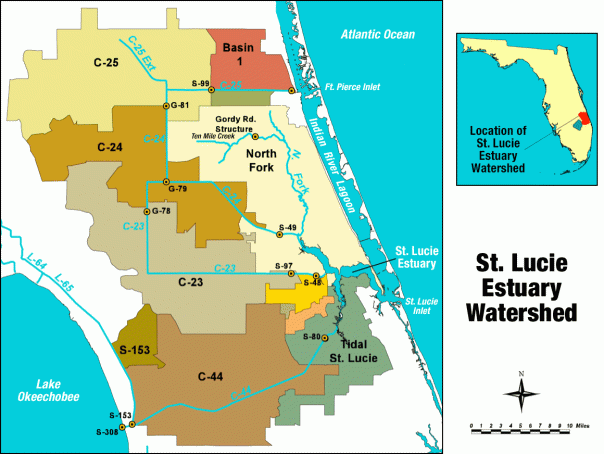
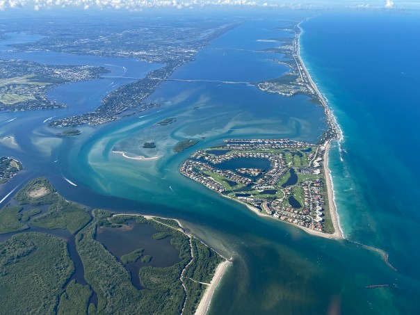
 Although I have no aerials for November 2022, I have three unpublished October aerials to share. They were taken by my husband, Ed Lippisch. One can see from the photographs the impact from canals C-23, C-24, C-44 and “local basin” runoff that accompanied Hurricane Ian that struck southwest Florida as a category 4 storm on September 28, 2022 – impacting the entire state. For weeks, the rains from Ian filled the St Lucie River. But by October 28th the river is clearing up.
Post Ian, Lake Okeechobee was not discharged into the St Lucie. The impacts of Nicole we do not know at this time, but whatever they are, they will not be good.
Lake Okeechobee sits at 15.89 feet.
Most recent water conditions ACOE Periodic_Scientists_Call_2022-10-25
-October 22, 2022 around 1pm, all aerials Ed Lippisch.
 SFWMD canal and basin map. C-44 canal is the canal most southerly in the image and is connected to Lake Okeechobee.
There will be a St Lucie River/Indian River Lagoon post Nicole update as soon as flight is possible.


If you can edit this, you should change your typo from 15.98 feet to 15.89 feet. So obsessives like me don’t get eye twitches and stuff, HA ha…Love your blogs, Jacqui. Keep up the good work.
Thank you so much Blake! Will do! I get a little nervous!!! Appreciate it!
Another obsessive here. Jacqui, would you edit this typo also?
“St Luice River”
Thank you so much!
Thank you Carol. Be safe.